Finland map
 https://www.sobaka.ru
Finland is a unitary state with a unique northern nature. Country located on the east coast of the Baltic Sea. Area is 338,145 km² (66th in the world). Population is 5,595,981 (116th place in the world).
The capital is the city of Helsinki. The official languages are: Finnish, Swedish, Sami (regional).
The state is located in northern Europe. In the east it has borders with Russia, in the north with Norway, in the west with Sweden, and in the south with Estonia. The shores of Finland are washed by the Baltic Sea and 2 bays: Finnish in the south and Botanical in the west. 25% of the land is located beyond the Arctic Circle.
Most of the believers profess Lutheranism and Orthodoxy.
2019 purchasing power parity GDP: $280 billion ($50,748 per capita).
2019 Nominal GDP: $269 billion ($48,810 per capita).
Finland was ranked 1st in the World Happiness Report 2018 published by the UN. In the next 4 years, it was also recognized as the happiest country in the world.
The climate in Finland is subarctic. Despite the fact that Finland is a northern country, its climate is strongly influenced by the warm course of the gulf stream in the Atlantic Ocean.
In Finland, seasons are very different from each other: summers can be very warm, winters can be very cold. The average temperature in Helsinki in southern Finland in July is +17.2°C and -4.2 in January, in Sodankylä in northern Finland +14.3 in July and -14.1 in January. In summer, temperatures in the east and south of the country can sometimes rise to +30°C. The southernmost parts of Finland are covered with snow an average of 75 days a year, while northernmost Lapland is covered with snow 200-225 days a year. The total amount of precipitation in the southern regions of Finland is 600-700 mm per year, and beyond the Arctic Circle 400-450 mm.
Timezone: UTC +3 Coordinates: 64°0′0″N, 26°0′0″E
Regions of Finland
Regions are divided into cities and communes, and large cities into urban parts. The representative bodies of cities are city councils (elected by the population).
The country is divided into 19 regions and 1 partial autonomy (Aland Islands).
Finland has 336 regions and 107 cities.
Finland obtained a 50 year lease on the Soviet part of the canal and Maly Vysotsky Island (Ravansaari) in 1963. Finland constructed a deeper 42.9 kilometers canal, which opened in 1968. In 2010, Finland obtained a second 50 year lease from Russia, but Maly Vysotsky was not included in the new deal.
The most interesting sights of Finland
Lake Saimaa
.jpg)
https://www.suomesta.ru
The largest lake system in Scandinavia, the fourth largest lake in Europe and largest in Finland. On the territory of Saimaa there are 13,700 islands, and the length of its coastline is almost 15,000 km. Saimaa is connected to the Gulf of Finland by the Saimaa Canal built in 1856, which today is not only the main water transport artery of Finland but also a popular cruise route. There are cities on the Saimaa: Lappeenranta, Mikkeli, Savonlinna.
On Saimaa you can rent a cottage, go fishing, go canoeing, kayaking, boating or yachting. In any of the towns of Saimaa you can rent a board for SUP-surfing. In winter, people go fishing on the Saimaa, ride lake skates and snowmobiles, and also practice ice diving.
Location: Finnish Lakeland, Finland Coordinates: 61°15′0″N, 28°15′0″E
Åland Islands

https://ru.tallink.com
One of the most amazing regions of Suomi. They are located on an island archipelago between Sweden and Finland, at the entrance to the Gulf of Bothnia of the Baltic Sea. There are more than 50 thousand islets in Åland, considering all the small skerries and rocks. 90% of the population here speaks Swedish. Mariehamn is the capital and only city of the archipelago. It is named after the Russian Empress Maria Alexandrovna.
Less than 30 thousand people live in Aland, but more than 2 million tourists come to the islands every year to visit the Mariehamn Maritime Museum, ride bicycles and motorcycles along the picturesque trails, go fishing for fun and just enjoy the leisurely island life.
Location: Finland Coordinates: 60°07′N 019°54′E
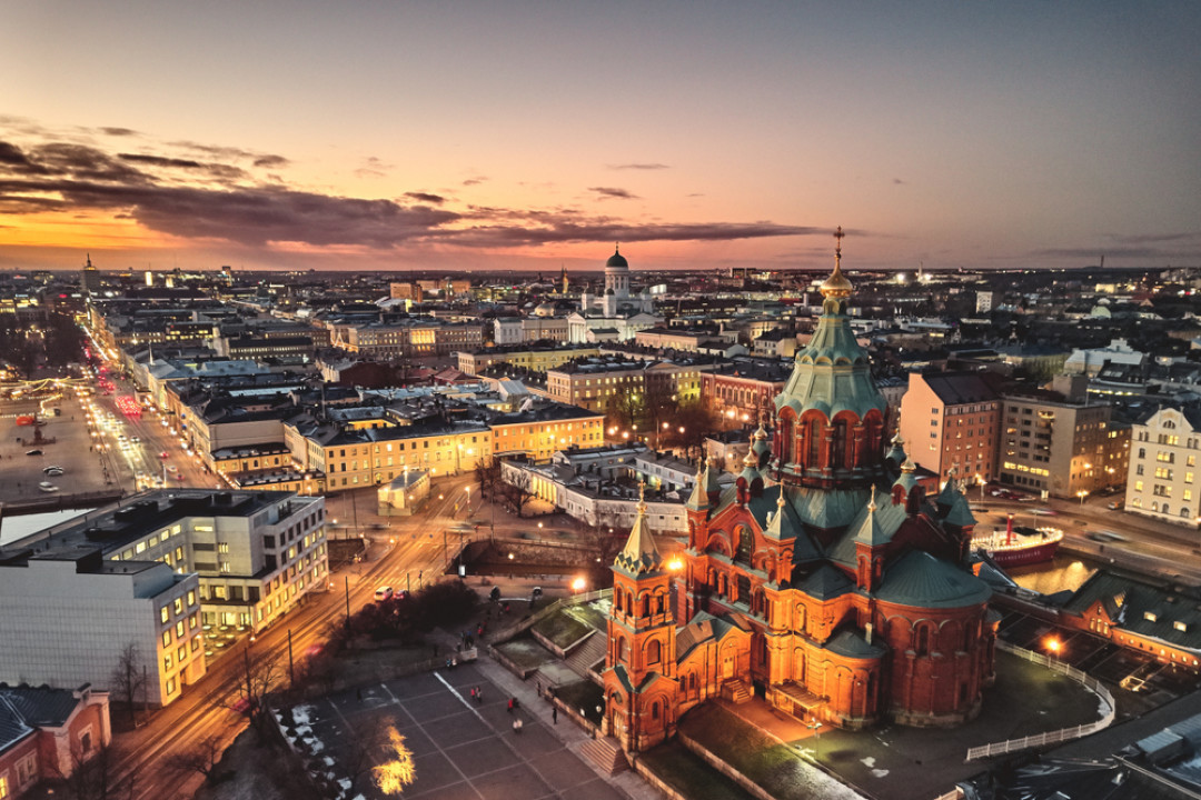
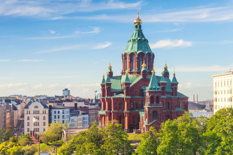
Uspenski Cathedral (Helsinki)
https://www.tripzaza.com
On the Katajanokka peninsula, the largest Orthodox cathedral in Europe was built. It was erected by order of Emperor Alexander II in honor of the Assumption of the Blessed Virgin Mary. The Assumption Cathedral is an important religious landmark in Finland, whose history dates back to between 1862 and 1868.
The cathedral was built according to the project of Alexei Gornostaev, which was based on another temple: the Church of the Ascension of the Lord in the village of Kolomenskoye. The very shape of the temple symbolizes the Holy Spirit. 13 domes represent Jesus Christ and the 12 apostles. The temple was built on voluntary donations. In 1868 the consecration of the cathedral took place.
Location: Kanavakatu 1, 00160 Helsinki, Finland Coordinates: 60°10′06″N 024°57′36″E
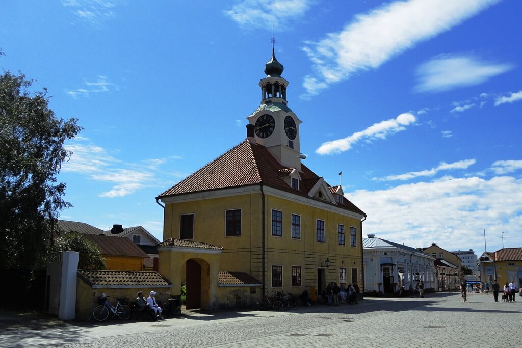
Old Rauma
 https://top10.travel
Historic center of Rauma. The city was founded in the 15th century. Most of the old wooden buildings burned down in fires. An interesting wooden building is the house of the sailor Christie, as well as the house of the shipowner Marel. They house museum exhibits. Stone buildings are represented by the Church of the Holy Cross and the City Hall.
Location: 26100 Rauma, Finland Coordinates: 61°07′42″N 21°30′42″E
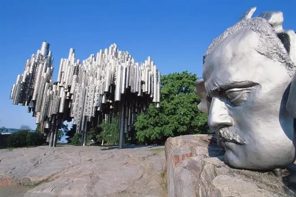
Monument to Sibelius (Helsinki)
https://top10.travel
Dedicated to one of Finland's most revered composers, Jean Sibelius. Sculptor Eila Hiltunen worked on the monument project for almost 10 years. Monument is a composition of 600 steel pipes. The music created by the wind creates an image of nature which often sounded in the compositions of Sibelius. The ambiguity of the monument is often criticized, while it is one of the most visited places by tourists.
Location: Mechelininkatu, Helsinki, Finland Coordinates: 60°10′55″N, 24°54′48.5″E
Parikkala
.jpg)
https://en.wikipedia.org
An inconspicuous settlement near the Russian-Finnish border. However, the extraordinary sculpture park of the self-taught Veijo Ryonkkönen attracts thousands of tourists here. Perhaps this is one of the strangest and mystical places in Finland. 500 human-sized concrete figures in various poses in the middle of the forest evoke mixed feelings. The sculptures grin and smile, showing park visitors real human teeth that Ryonkkönen was supplied by his dentist friends.
The sculptor was creating his collection for 50 years and put into it all his children's complexes, fears, thoughts. He admired the human body, was fond of yoga. All of this is reflected in the theme of his collection.
Location: South Karelia, Finland Coordinates: 61°33′N 029°30′E
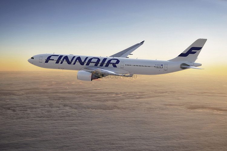
Airports in Finland
https://e-finland.ru/
There are more than 20 civil airports in Finland, some of them have international status.
|
|
|
|
|
|
|
|
|
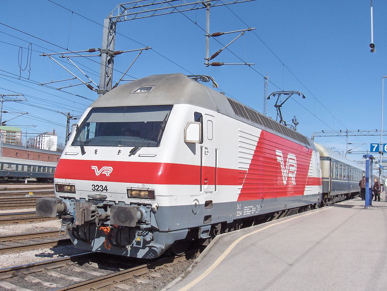
Railways of Finland
https://ru.wikipedia.org
The railway network in Finland consists of railways with a total length of 9216 km, total length of passenger rail routes 7225 km.
|
|
|
|
|
|
|
|
|
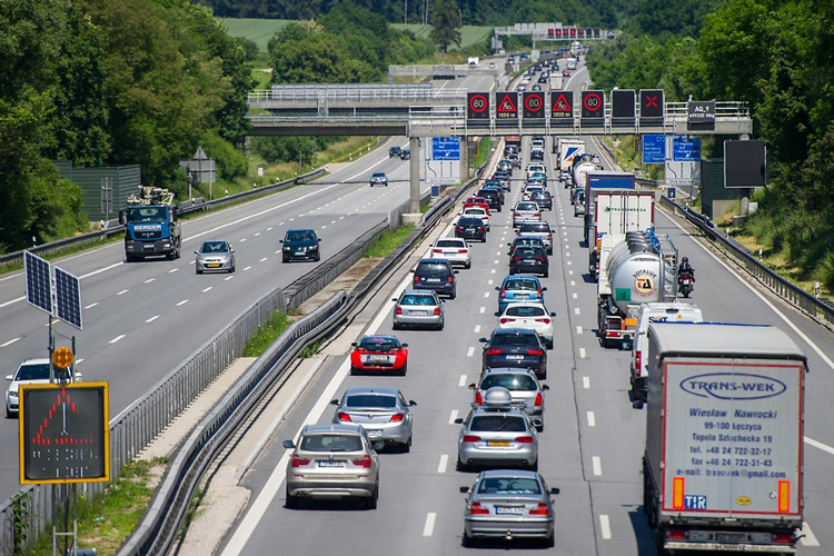
Highways in Finland
https://e-finland.ru/
Roads in Finland include 78,141 km of motorways, paved roads and gravel roads.
The total length of public roads, private and forest roads and streets in Finland is about 454,000 kilometers.
Speed limit:
Cars:
- in built-up area: 50 km/h
- outside the settlement: 80 km/h
- on the highway: 110 km/h
- on the motorway: 130 km/h
Trailer vehicles and motorcycles:
- in built-up area: 50 km/h
- outside the settlement: 80 km/h
- on the road: 80 km/h
- on motorway in winter: 100 km/h
- on motorway in summer: 120 km/h
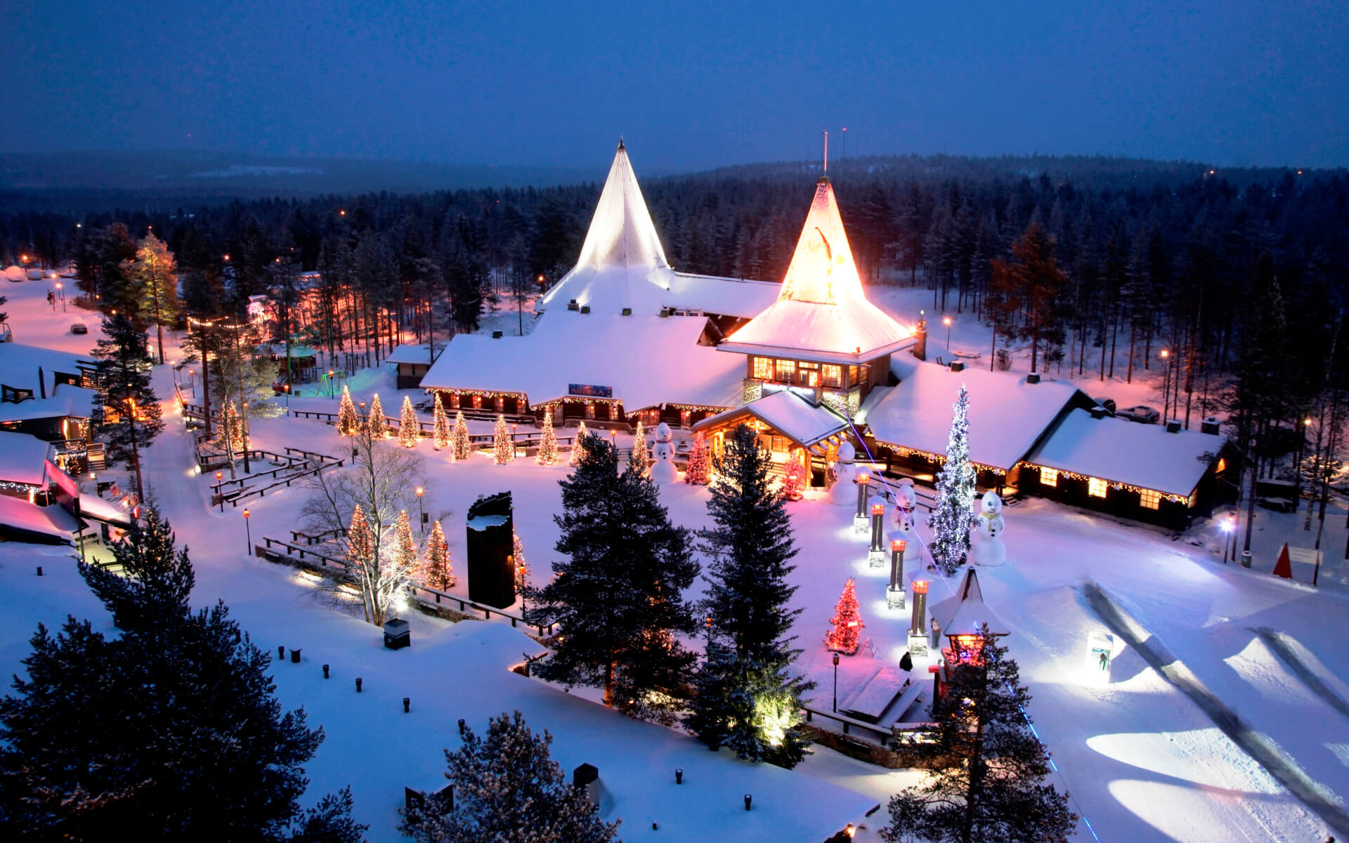
Editor's Choice: Santa Claus Village
 https://tonkosti.ru
Santa Claus Village is an amusement park in Finland dedicated to the Christmas Santa (who is called Joulupukki in Finland). It is located near the city of Rovaniemi, province of Lapland.
According to tradition, Santa Claus is believed to have been born in Lapland. Santa Claus Village is considered to be his immediate residence, and therefore is one of the most visited tourist destinations in Finland.
Location: 96930 Rovaniemi, Finland Coordinates: 66°32′36″N 25°50′51″E