Japan map
https://rahaholidays.com
Japan is an island nation in East Asia. It is located in the Pacific Ocean, on the Japanese archipelago (consisting of 6852 islands). It is washed by the waters of the Sea of Okhotsk in the north and the East China Sea in the south. The four largest islands (Honshu, Hokkaido, Kyushu and Shikoku) make up over 95% of the total area of the archipelago. Many islands are volcanic. The highest point in Japan is Fujiyama volcano (3776 m).
The population of Japan is 125 million people (11th in the world). Greater Tokyo is the largest urban agglomeration in the world, which includes the capital of Japan Tokyo and several nearby prefectures, with a population of more than 30 million people.
Japan ranks 3rd in the world in terms of nominal GDP. The country has a very high standard of living (12th in the Human Development Index). Japan also has one of the highest life expectancies (85.3 years in 2017) and one of the lowest infant mortality rates.
Japan is a member of the G7 and APEC, and is regularly elected as a non-permanent member of the UN Security Council.
Japan belongs to a temperature zone with four distinct seasons, but its climate ranges from cold in the north to subtropical in the south.
The Japanese islands are part of the Pacific volcanic ring of fire. 10% of the world's volcanic activity in the early 1990s was recorded in Japan. Up to 1,500 earthquakes every year with a magnitude of 4 to 6 are not unusual. Small earthquakes occur daily in different parts of the country, causing buildings to shake.
Forests cover over 66% of the country. The flora of Japan has more than 700 species of trees and shrubs and about 3,000 species of herbs.
Timezone: UTC+9:00 Coordinates: 36°0′0″N, 138°0′0″E
Regions of Japan
Japan is divided into 47 prefectures. Each prefecture is governed by a prefect (governor, in the case of Hokkaido). Prefectures have their own legislative and administrative apparatuses. In turn, the prefectures are divided into smaller administrative units: Hokkaido's 14 districts, counties, and special cities (whose population exceeds 500,000 people).
In addition to prefectures and counties, there are administrative units at the municipal level in the country, which enjoy wide autonomy.
The most interesting sights of Japan
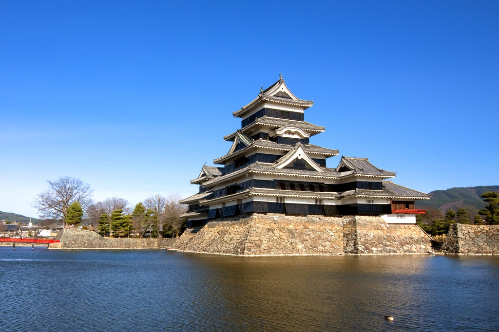
Matsumoto Castle
https://putidorogi-nn.ru
An ancient Japanese castle called the Crow Castle (for the black color of the walls and outstretched "wings" of the side towers).
In 1593-1594, the existing five-tiered castle was erected. One side of the complex was intended for contemplation of the moon and was called ‘lunar chambers’.
Its five-story main tower from the late 16th century is the oldest surviving castle tower in the country.
Entrance to the outer courtyard of the castle is free. Here you can admire swans and Japanese carps.
In the evening, the castle is illuminated and beautifully reflected in the water. You can enter the castle courtyard for a small fee. There is a beautiful garden there.
It is listed as a National Treasure of Japan and is one of the twelve original tenshū in Japan that have survived.
Location: Matsumoto, Nagano Prefecture, Japan Coordinates: 36°14′20″N, 137°58′9″E
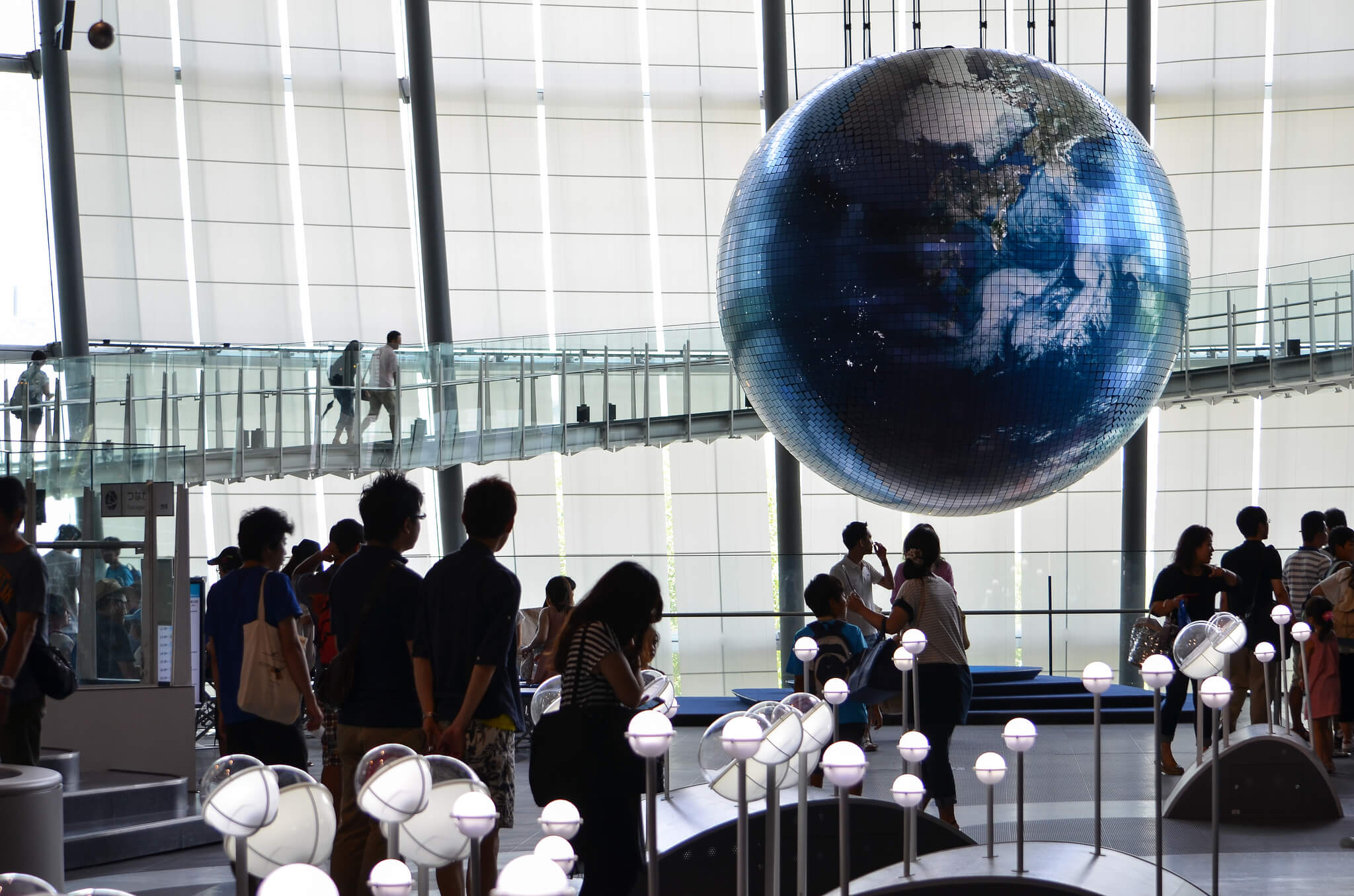
Miraikan Innovation Museum
https://tonkosti.ru
Miraikan is one of Tokyo's modern museums dedicated to innovation and the advancement of science. The museum was established by the Japan Science and Technology Agency in 2001. It is located in the Odaiba district of Tokyo.
In addition to exhibitions, the museum offers experiential sessions and talks. Visitors can see the technological progress of today, from simple everyday issues, to the latest technologies, the global environment and space exploration.
It is also worth mentioning the exposition, which includes a live broadcast of data from seismometers located in different parts of Japan.
The museum is headed by one of the first Japanese astronauts, Mamoru Mori.
Location: Odaiba district, Tokyo, Japan Coordinates: 35°37′8.4″N, 139°46′37.2″E
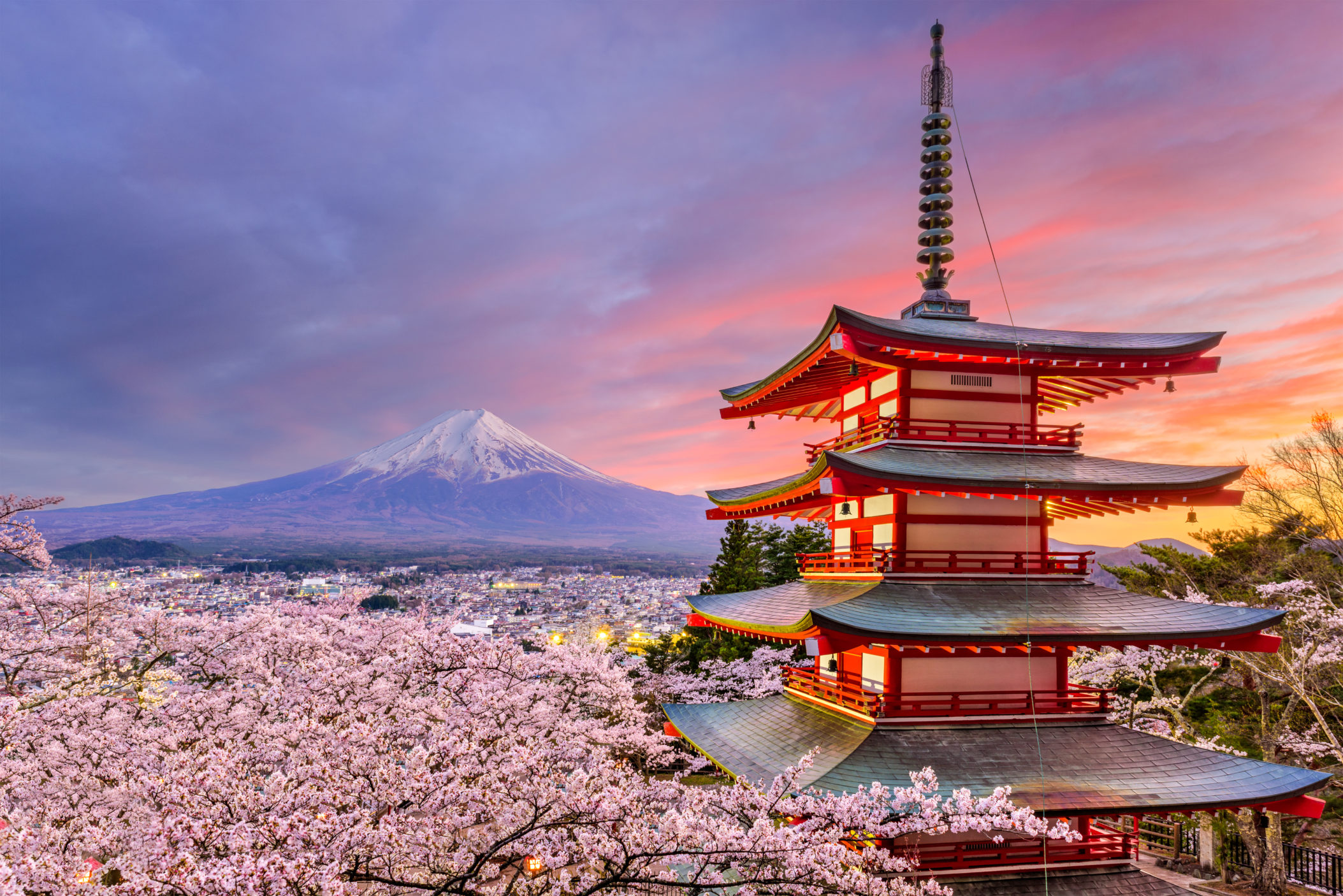
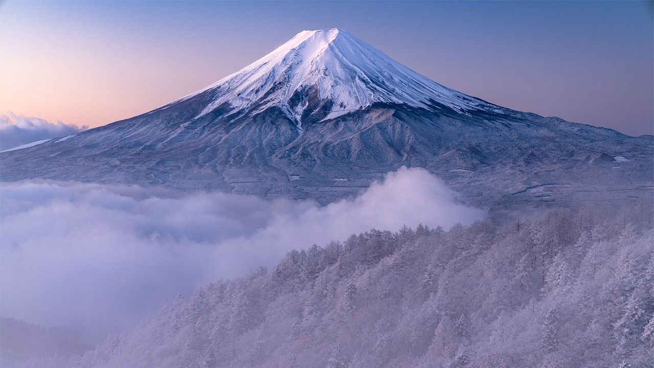
Mount Fuji
https://www.nippon.com
Mount Fuji is the highest mountain in Japan (3776 m). It was formed as a result of volcanic activity about a hundred thousand years ago. It is located on the island of Honshu in the Fuji-Hakone-Izu National Park
Fujiyama is considered weakly active. The last eruption was recorded in 1707-1708. It was one of the most powerful eruptions in the history of Mount Fuji. Then in Edo (the old name of Tokyo) a 15 cm layer of ash was formed.
Climbing the mountain can take from 3 to 8 hours, descending from 2 to 5 hours (depending on your physical fitness). The entire route is divided into stations. As a rule, tourists get to the fifth station by taxi or bus, and then go on foot. At the very top of Fuji, there is a Shinto shrine, a post office and a weather station. There are a lot of hot springs on the volcano and near its foot.
Fuji has been a popular subject in Japanese art for centuries.
It is a UNESCO World Heritage Site.
Location: Island of Honshū, Japan Coordinates: 35°21′38″N, 138°43′39″E
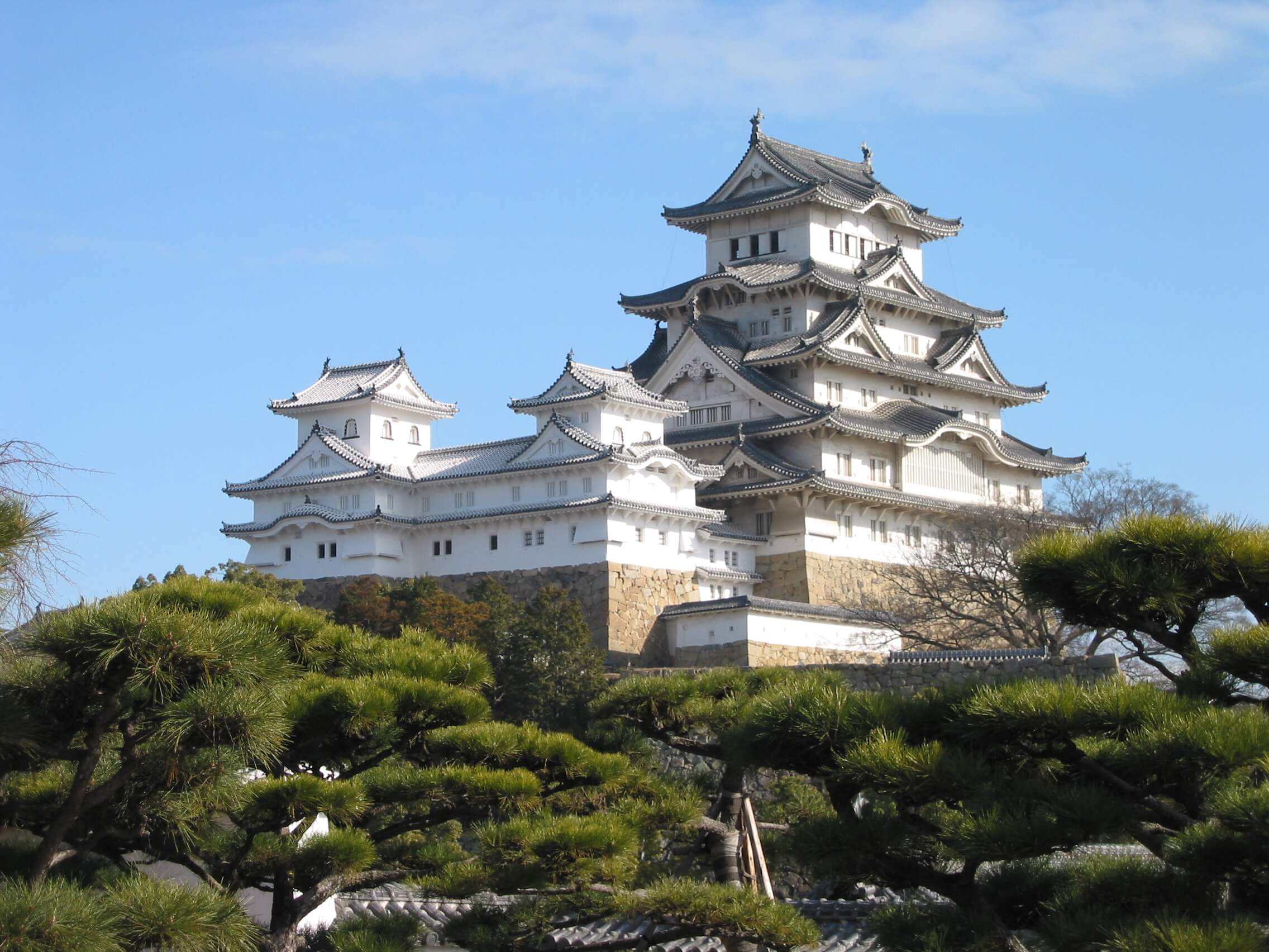
Himeji castle
https://ru.wikipedia.org
There are 83 structures in the castle, almost all of them are made of wood.
The castle was built in the 1330s.
Internally, Himeji is decorated with wooden carvings and golden sliding partitions depicting birds, trees, and flowers. In the halls of the castle you can find samurai armor. On the top floor there is a tiny shrine where, according to a legend, lives the soul of the legendary samurai, Miyamoto Musashi. Around the castle are the picturesque gardens of Koko-en with waterfalls, pine trees, bamboo wattle fences, stone paths, gazebos and ponds overgrown with lotuses.
Since 1993, it has been taken under the protection of UNESCO. Also, the White Egret Castle is a National Treasure of Japan.
Location: Himeji, Hyōgo Prefecture, Japan Coordinates: 34°50′22″N, 134°41′38″E
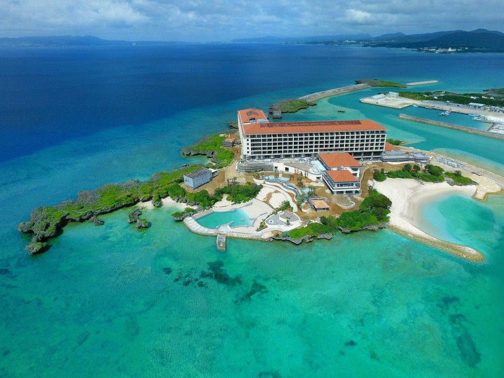
Okinawa Island
https://advantiko.com
Okinawa Prefecture (Ryukyu Archipelago) consists of 160 islands (40 of which are uninhabited), stretching for 400 km from north to south and 1000 km from east to west. Okinawa island has a distinctive and unique culture, history and philosophy of life.
The area of the island is 1206.98 km², the length of the coastline is 476 km.
The main city is Naha (314,358 inhabitants). From Naha, the highway leads to the city of Shuri, the ancient residence of kings.
In the Middle Ages, the Ryukyu kingdom existed in Okinawa, which was subjugated by the Japanese in 1879. The ruins of medieval fortifications, gusuku, are scattered around the entire perimeter of the island. They are World Heritage Sites.
The northern part of the island is composed of igneous rocks; in fact, it is a low-mountain volcanic massif. A maximum elevation is Mount Yonaha (503 m), which is also the highest point of the island.
Location: Japan Coordinates: 26°28′46″N, 127°55′40″E
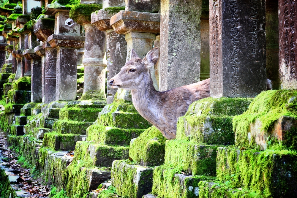
Nara City
https://www.onetwotrip.com
The capital of Nara prefecture. Numerous temples, shrines and other structures have remained in the city since ancient times.
Nara was the capital of Japan during the Nara period (from 710 to 784). In those days, it was called Heijo-kyo. The legends about the founding of the city are found in the historical chronicles of the Nihon Shoki. According to legend, it was here that the first Japanese emperor Jimmu set foot on Japanese soil, where he laid the foundation for Japanese statehood.
Nara is notable for the largest wooden temple in the world, Todai-ji. It is an architectural complex and is located in the city center. On the territory of the complex there is a deer park, where sacred animals roam freely.
In total, 1200 deer live in the city park. Entrance to the territory is free. Vendors usually stand in the shade of the trees and sell special animal crackers.
Location: Nara prefecture, Honshu, Japan Coordinates: 34°34′0″N, 135°46′0″E
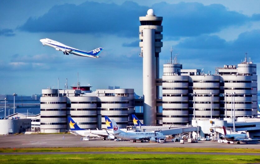
Airports in Japan
https://trip-advice.ru
Japan today has dozens of airports; both international and intended to serve domestic flights.
|
|
|
|
|
|
|
|
|
Japan Railways
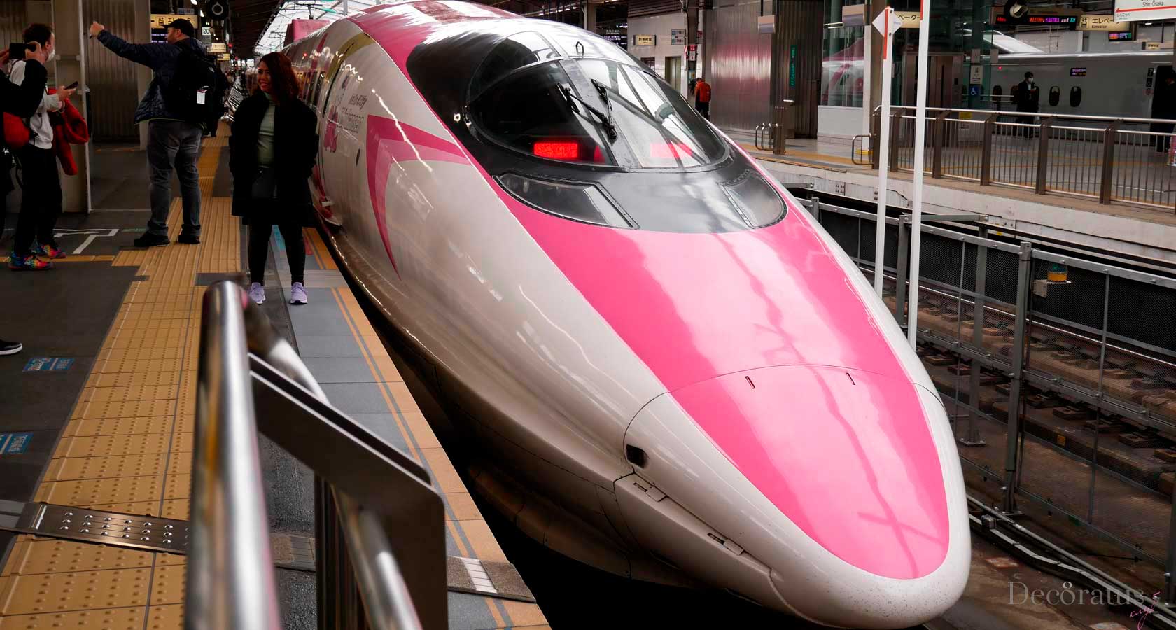
https://decoratus8.club
Rail transport in Japan is the main means of transporting passengers in Japan, both between large cities and on suburban lines.
|
|
|
|
|
|
|
|
|
Japanese highways
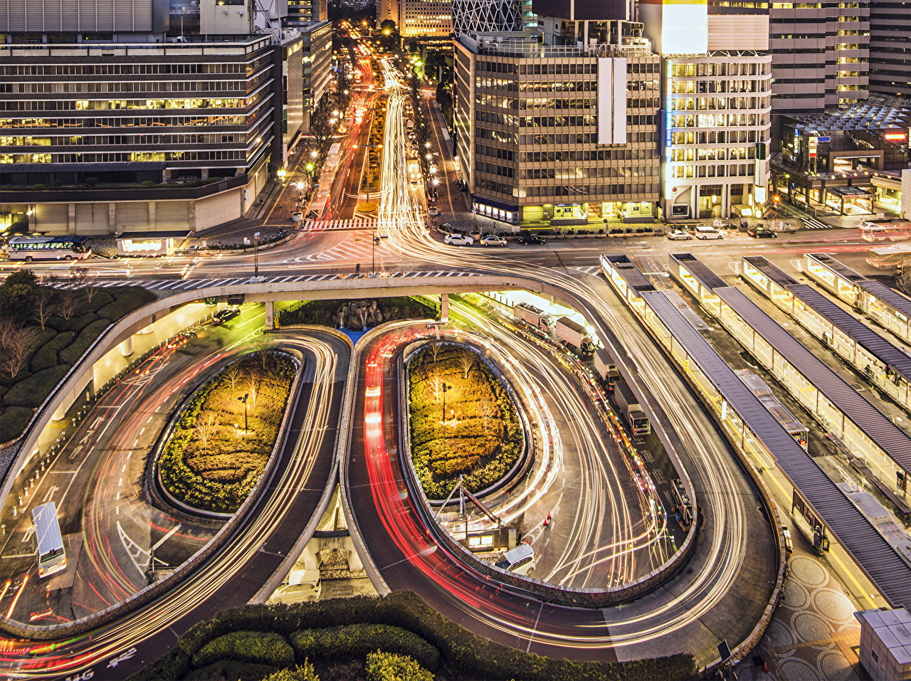
https://10-ds.ru
As of April 2012, Japan's road network was approximately 1,215,000 kilometers long.
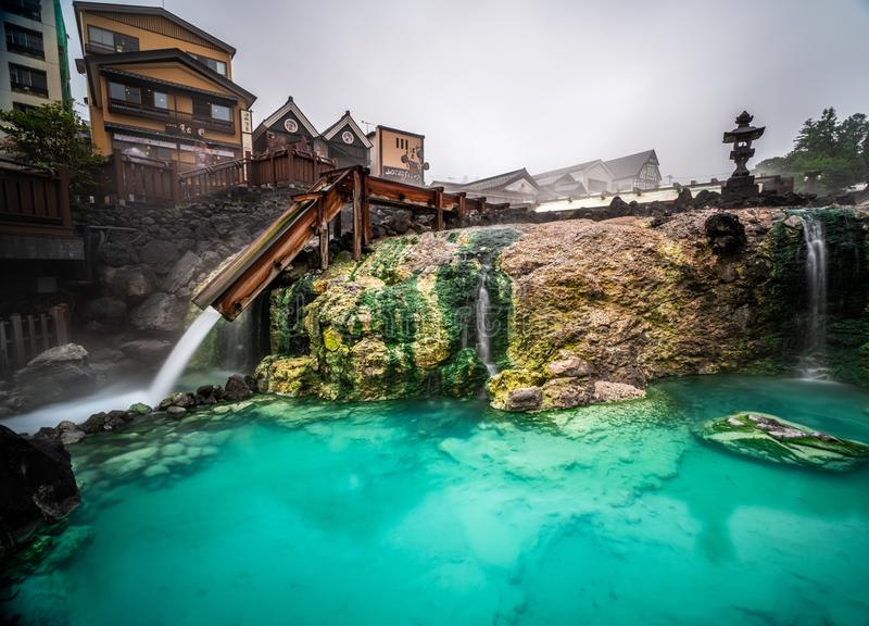
Editor's Choice: Kusatsu Hot Springs
https://thumbs.dreamstime.com
Kusatsu is Japan's premier natural hot spring resort.
The Kusatsu hot spring area is located on a plateau at an altitude of 1200 meters above sea level. It is known for the largest volume of natural thermal water in Japan. This spa resort in Gunma Prefecture is considered one of Japan's three most famous hot spring areas, along with Arima in Hyogo Prefecture and Gero in Gifu Prefecture.
Some baths offer special baths and treatments where bathers soak in extremely hot water (typically 48 degrees Celsius) for three minutes. Hot water opens the pores and increases blood flow to the brain.
Location: Gunma Prefecture, northwest of Tokyo, Japan
Coordinates: 36°38′18″N, 138°35′36″E