Ukraine map
https://udf.name
Ukraine is a unitary state with a rich cultural and historical heritage. Located in Eastern Europe. Area - 603,549 km² (44th in the world), population - 40,997,699 permanent residents (34th in the world).
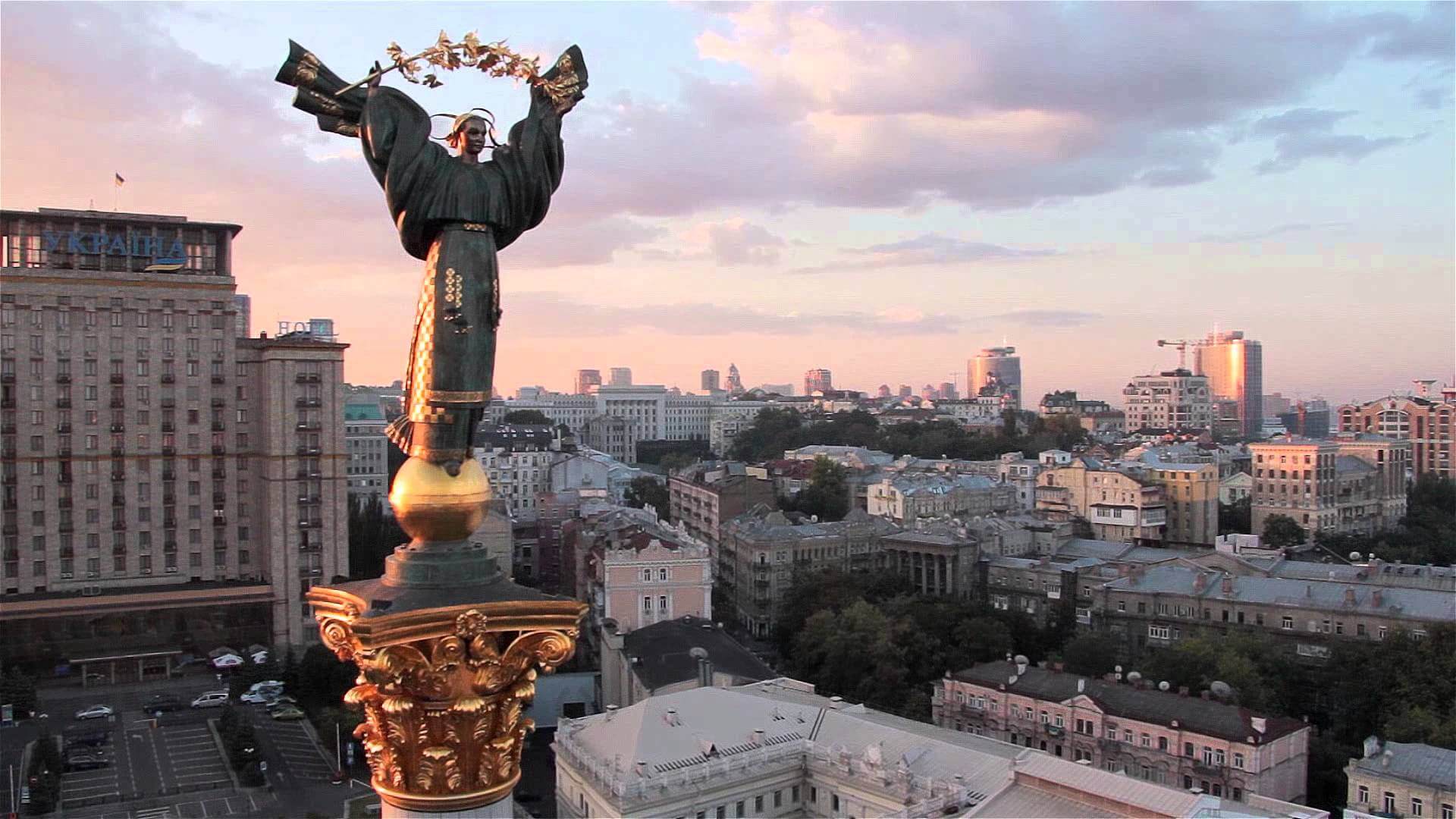
The capital is the city of Kyiv. The state language is Ukrainian.
It borders Belarus in the north, Poland, Slovakia and Hungary - in the west, Romania and Moldova - in the southwest, Russia - in the east, northeast. Maritime borders with Romania in the Black Sea and with Russia - in the Black and Azov. It is washed by the Black and Azov Seas in the south and southeast.
Part of the territory of Ukraine is controlled by the partially recognized Donetsk People's Republic and the Lugansk People's Republic, part by Russia (Crimean Peninsula).
Most of the population professes Orthodoxy, there are also adherents of Catholicism and Greek Catholicism, as well as Judaism and Islam.
2021 GDP at purchasing power parity: $584.1 billion ($14,145.9 per capita) Nominal GDP in 2020: $203.3 billion ($3,631 per capita)
The climate is temperate continental. The Carpathians are characterized by a mountainous type of climate, while the territory of the Crimea has a subtropical climate of the Mediterranean type.
Summer is long, warm or hot, the average temperature in July is +18-24°C. Winter strongly depends on the region, the average temperature ranges from -8°C to +2-4°C. Mild winters are observed in the south and west of the country; the coldest winters are observed in the northeast. The average annual precipitation is 600 mm, while varying significantly depending on the region: up to 1600 mm of precipitation per year falls in the Carpathians, 400-300 mm in the south and southeast.
Timezone: UTC+2 Coordinates: 49°0′0″N, 32°0′0″E
Regions of Ukraine
The country is subdivided into 27 administrative-territorial units: 24 regions,1 autonomous republic (Crimea), 2 cities of state subordination (Kyiv, Sevastopol).
There are 490 districts, 459 cities, 885 urban-type settlements and 28,450 villages and other settlements in Ukraine.
The most interesting sights of Ukraine
Khotyn fortress
-tmb-1200x628xfill.jpg)
https://incomartour.com.ua/countries/30/2299
Khotyn fortress is one of the most spectacular places in Ukraine. It is located on the banks of the Dniester, 25 km from Kamenets-Podolsky. It belonged to Kievan Rus, Galicia-Volyn principality, Moldavian principality, Turkey, Poland, Austria-Hungary, Russian Empire and Ukraine. Over the centuries, it has been repeatedly reconstructed and expanded, destroyed and rebuilt again. It is believed that the first wooden fortifications on this site were founded at the beginning of the 11th century by Kyiv prince Vladimir the Great.
When the Mongol-Tatar yoke conquered Russia, the role of this fort greatly increased; it guarded the most important crossing on the Dniester River from the raids of nomadic robbers. Until the 19th century, battles were constantly taking place on this site. The fort later lost its military status. The settlement received its own emblem, a church was built inside in honor of Alexander Nevsky. At present, the fortress is a museum. Inside are: a monument to Petro Konashevych-Sahaidachny (Hetman of Ukrainian Zaporozhian Cossacks), 5 towers, churches, a princely palace, barracks, an entrance to a dungeon, the ruins of a mosque and a military school.
Location: Khotyn, Ukraine Coordinates: 48°31′19″N, 26°29′54″E
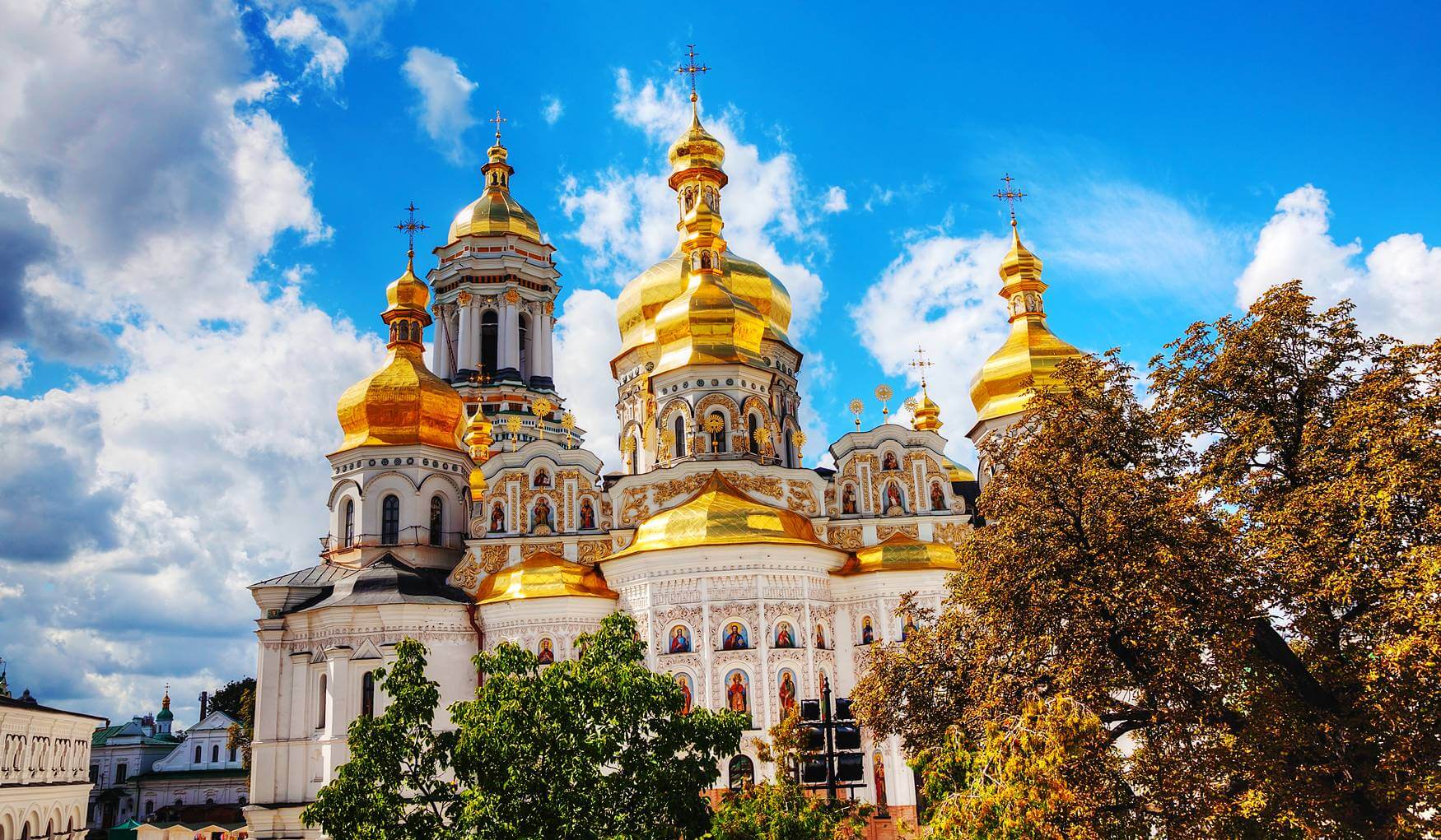
Kiev-Pechersk Lavra
https://kidpassage.com
The Holy Assumption Kiev-Pechersk Lavra is the first and oldest monastery on the territory of modern Ukraine. The Caves Monastery was founded in 1051 under Yaroslav the Wise by monk Anthony, a native of Lyubech, and his disciple Theodosius. In the dungeon is the main treasure of the Lavra: the holy imperishable relics of the righteous.
For a thousand years of its existence, the Lavra suffered many disasters: earthquakes, the invasion of the Mongol-Tatars, fires and wars. But after each shock and destruction it was reborn.
Location: Kyiv, Ukraine Coordinates: 50°26′3″N, 30°33′33″E
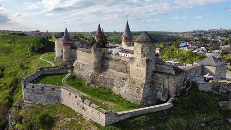
Old castle of Kamenetz-Podolsk
https://afisha.bigmir.ne
Kamianets-Podilskyi castle is located in the city of Kamianets-Podilskyi. Known since the 14th century as part of the defensive system of the city of Kamenets. It is an integral part of the National Historical and Architectural Reserve ‘Kamenets’. The history of the Old Fortress began in the 12th century. Already in those days, it reliably defended the city.
From 1362 to 1434, the castle, in combination with the city's defense structures, became the main outpost of the Lithuanian, and from 1434 to 1793, the Polish authorities in Podolia, and played a significant role in repelling the Turkish-Tatar campaigns to the West. Until the 19th century, the city was conquered in turn by the Turks, Poles, and the Russian Empire. When it had already ceased to have its former military significance, it became a museum-reserve and one of the most visited Ukrainian sights.
Location: Kamianets-Podilskyi, Ukraine Coordinates: 48°41′0″N, 26°35′0″E
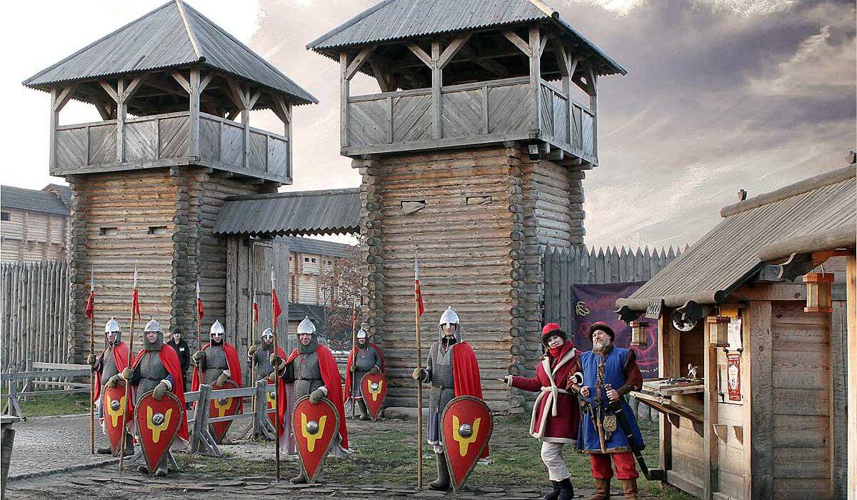
Kievan Rus Park
https://kidpassage.com
Ancient Kyiv in the Principality ‘Kievan Rus’ is the center of culture and history of Ancient Rus. This is a recreation of the cultural and architectural image of ‘Kyiv Detinets’ of the 5th-13th centuries in its historical dimensions and the atmosphere of Kievan Rus, using all the scientific knowledge available today. Area of 10 hectares.
Kievan Rus Park is located 45 minutes away from modern Kyiv. The complex is a real living medieval city with its masterpieces of architecture, ancient crafts and incredibly spectacular medieval shows.
Museums of historical costume, medieval music, wooden architecture, expositions of siege equipment, shipbuilding, and even a medieval torture chamber await guests.
Location: Kyiv, Ukraine Coordinates: 50°8′43.08″N, 30°28′27.84″E
Old city of Lviv
_16.jpg)
https://ru.wikipedia.org
The old city of Lviv is a beautiful historical monument of Ukraine. A large number of ancient buildings are surprisingly collected on the square: 4 large churches, 3 ethnic quarters, several dozen centuries-old houses, all kinds of sculptures and even fragments of a fortress. Numerous souvenir shops, restaurants and cafes complement the rest in the old town, where you can relax while walking.
Location: Lviv, Ukraine Coordinates: 49°50′30″N, 24°1′55″E
Tunnel of love

https://kraina-ua.com
It is a botanical phenomenon: a green tunnel in a forest about 4 km long, created by thickets of trees and bushes that intertwined with each other and created a dense tunnel of an exact arched shape. An industrial train passes along this track three times a day. He maintains this place in this state, breaking off the overgrown branches of trees.
This attraction is especially popular among romantics who come here to make a wish, and photographers who get a lot of high-quality and interesting pictures. The tunnel is located in the forest near the town of Klevan in the Rivne region.
Not far from this place is a medieval castle, shrouded in legends and myths.
Location: Klevan, Ukraine Coordinates: 50°45′3.24″N, 26°2′45.96″E
Airports of Ukraine
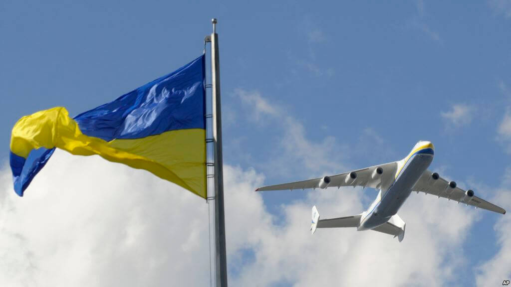
https://aviav.ru/airports/ukraine
The State Aviation Service of Ukraine is responsible for issues related to civil aviation.
|
|
|
|
|
|
|
|
|
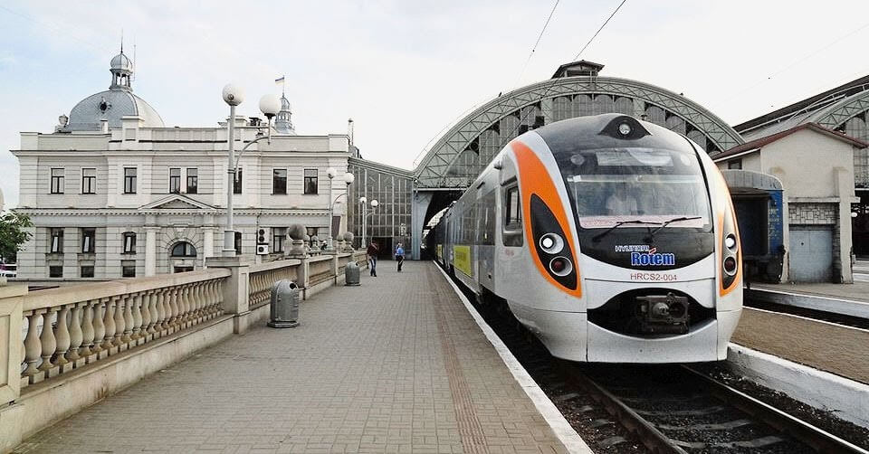
Railways of Ukraine
https://zdmira.com
Railway transport plays a significant role in ensuring the vital activity of the Ukrainian economy, which accounts for 82% of freight traffic (excluding pipelines) and almost 40% of passenger traffic carried out by all modes of transport. The length of railway lines under the jurisdiction of the State Administration of Railway Transport of Ukraine in 2010 was almost 22 thousand km, the number of cars in the freight fleet was 124.5 thousand.
On the territory of Ukraine there is also a powerful railway transport of industrial enterprises, which plays an extremely important role in the sphere of production. The total length of these railways at the end of 1997 was 28,000 km.
1614 stations, 120 main stations. Depot: 50 locomotives, 43 wagons, 13 passenger wagons.
Rolling stock: 57.7 thousand freight cars, 3883 passenger cars, 63 branded passenger trains, 720 mainline diesel locomotives, 1256 shunting diesel locomotives, 1720 mainline electric locomotives, 1693 sections of electric trains and diesel trains.
|
|
|
|
|
|
|
|
|
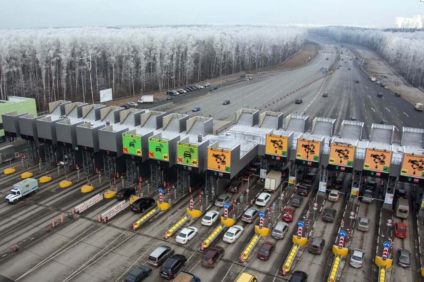
Highways of Ukraine
https://www.ua-bud.com.ua
The network of public roads includes 172.4 thousand km of roads, of which 164.1 thousand km are paved (excluding municipal, departmental, intra-farm roads).
Standard speed limits in Ukraine, unless otherwise indicated on the signs:
Cars:
- in built-up area - 50 km/h
- outside the settlement - 90 km/h
- on the road - 110 km / h
- on the motorway - 130 km/h
Trailer vehicles and motorcycles:
- in built-up area - 50 km/h
- outside the settlement - 80 km/h
- on the road - 80 km/h
- on the motorway - 80 km/h
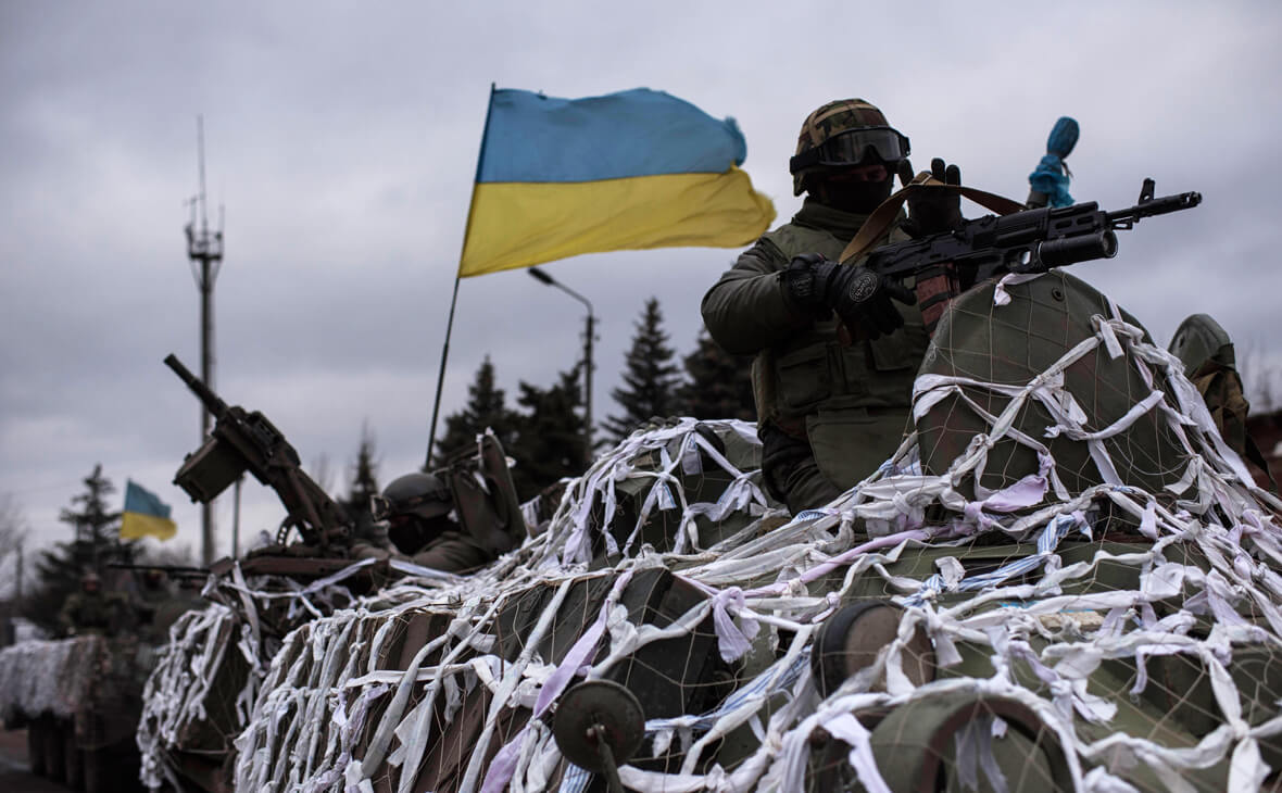
Editor's Choice: Military conflict in Ukraine
https://www.rbc.ru
The Russo-Ukrainian war (‘special military operation’ in Ukraine) is an armed conflict between Russia and the self-proclaimed republics of the DPR and LPR supported by it on the one hand, and Ukraine on the other.
On February 21, Russia recognized the independence of the DPR and LPR, on February 22 officially sent troops into the territory controlled by them, and on February 24 launched a full-scale invasion of Ukraine.
Russian troops entered the territory of Ukraine from Russia, Crimea and Belarus. The troops of the Donetsk People's Republic (DPR) and the Lugansk People's Republic (LPR) also joined the fighting. The troops launched an offensive in four main directions: from the north towards Kyiv, from the northeast towards Kharkov, from the southeast from Donbass and from the south from Crimea.